|
|||||
Once in about a 15 years the sea between Finland mainland
and Åland (the biggest island, an autonomic area) freezes so solid
it's possible to drive there by a normal car. |
|||||
|
|||||
From Finland to Åland via ice - a trip of 120 kilometers over frozen sea. |
|||||
 just beginning |
When we heard that the famous ice road from Turku to Marienhamn was going to be opened, the decision was easy. We had to try this out. Due to warm weathers, this decades old tradition of ice roads in the archipelago had withered during recent years (we can talk about enviromental warming etc, who knows?). In 50' ice roads had still some importance in Finnish travelling routes, but after that the normal road network had improved so much that they have become a curiosity. |
 just a road. |
|||
 road ends |
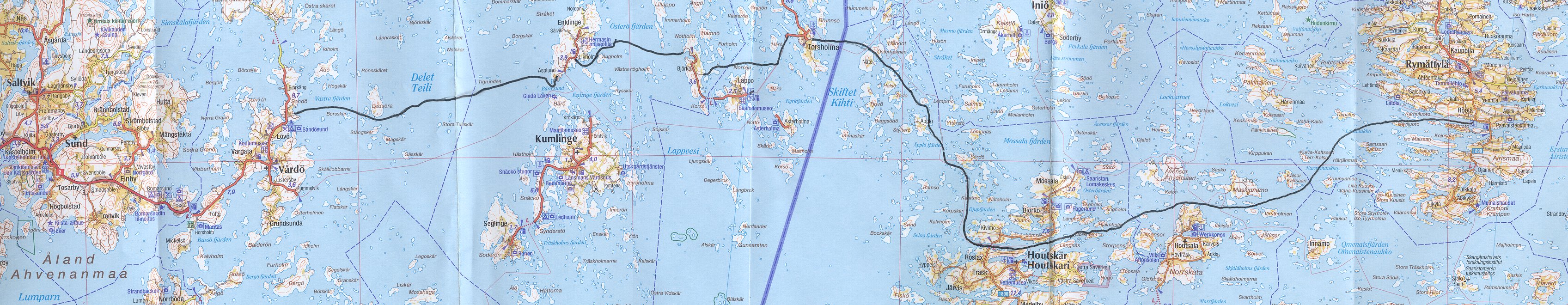
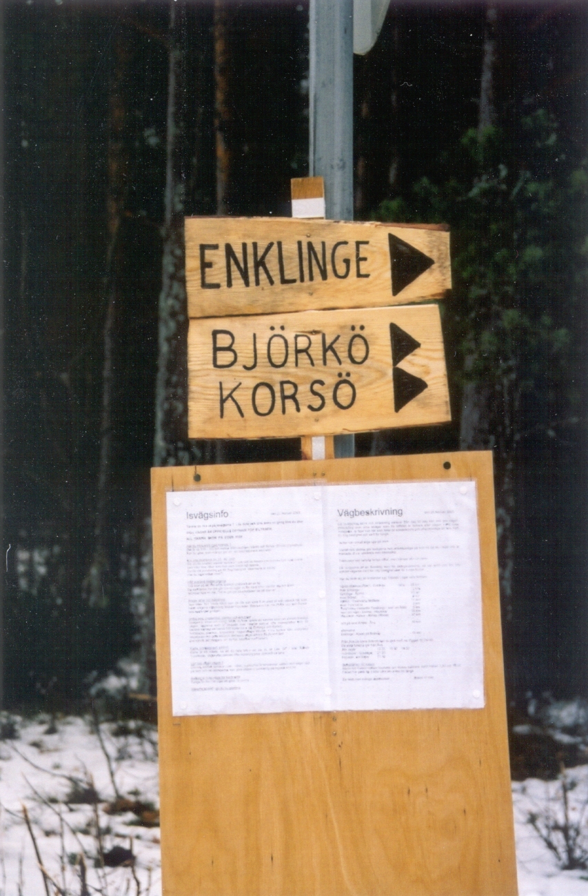
The most widely known has always been the route between Finnish mainland and the Åland islands. The last time this route was officially open was early 1990's. Nothing forbids you to TRY the route even on warmer winters, but only when officially declared the road has all the needed movable bridges over ship paths. The road starts on Rymättylä and goes through/nead the islands Houtskär, Torsholma, Lappo and Enklinge to Vårdö in Åland. The nominal lenght of the route is about 120 kilometres. |
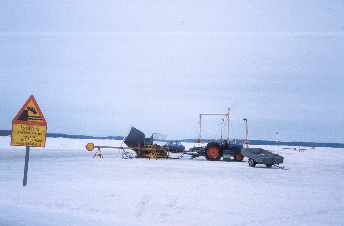
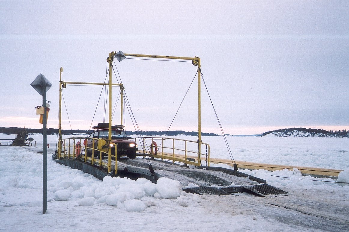
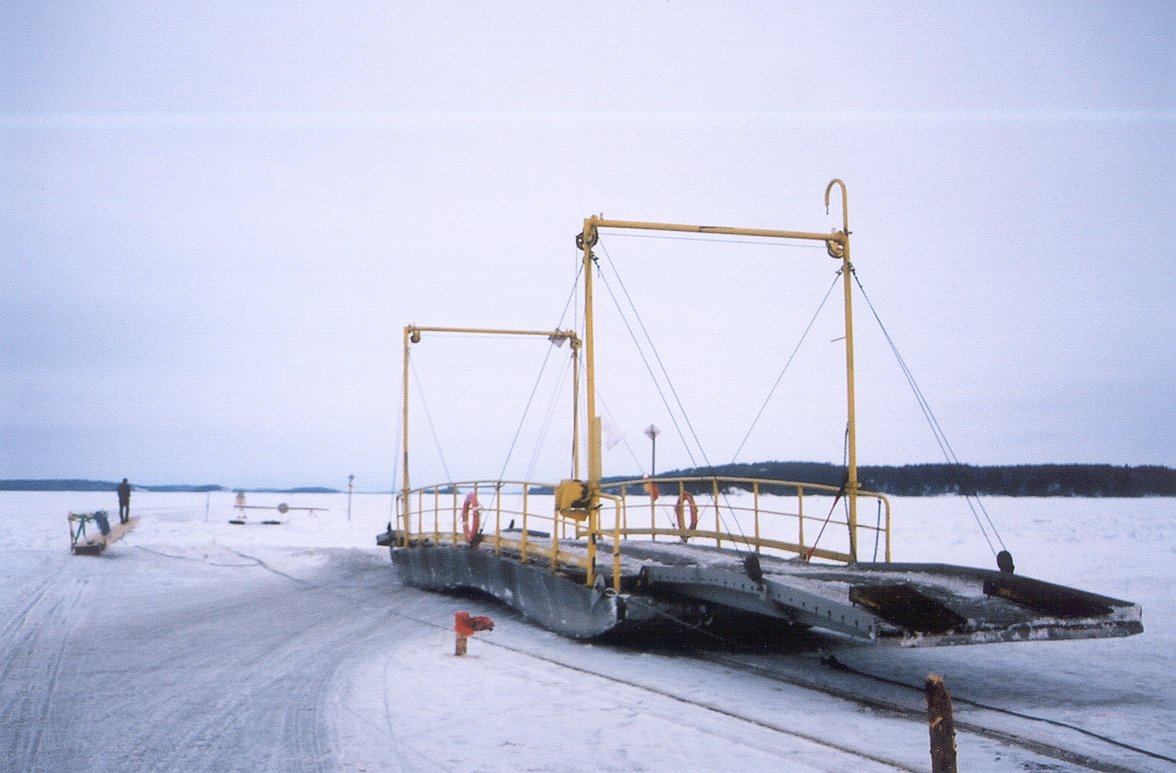 channel bridge |
|||
 over it |
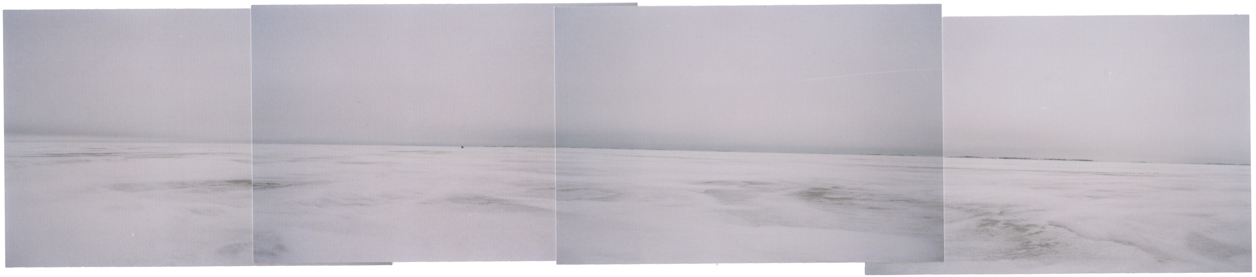
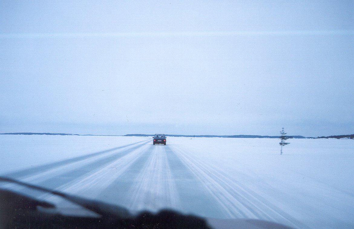
The exact lenght varies from day to day, becouse only the crossing-over are on fixed points. The road itself is generally not marked, you only drive by old tracks. Sometimes an archipelago inhabitant takes a shortcut, or weather makes one place difficult, so everyone drives by another route. You definitely need a map, and a compass is a good help. In a clear area between islands you can miss the route by 10 kilometers before noticing, as we did found out during the trip. The start- and endpoints resemble a normal road, because the traffic is quite heavy (50 cars in an hour), but in the middle the road can be quite hard to find. Near big islands, on the other hand, it's maze. |
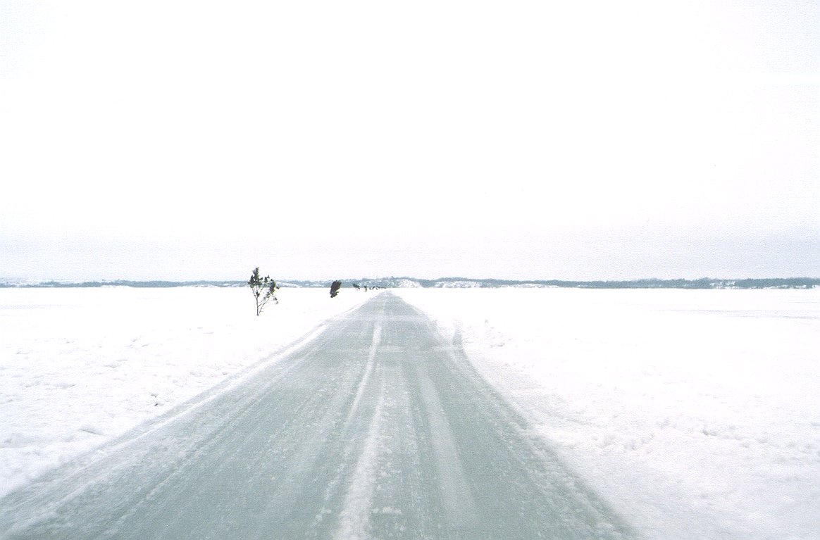 straight ahead |
|||
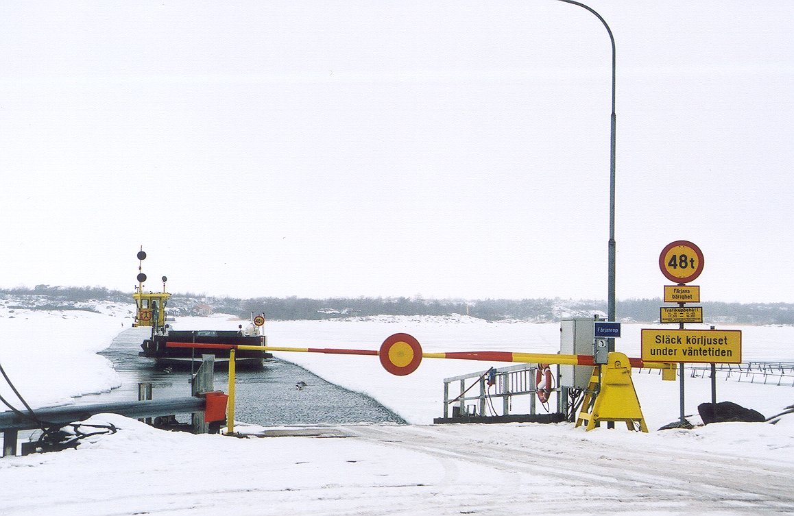 a ferry |
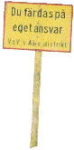
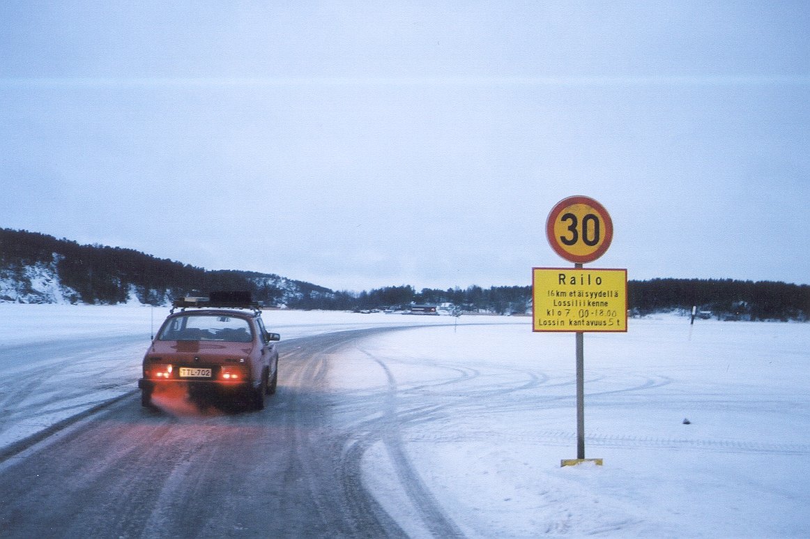
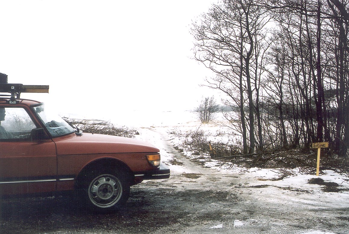
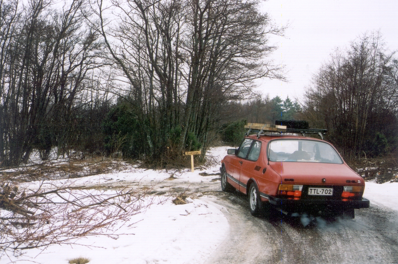
We started the trip at 6 am, by equiping our trusty Saab 99 with warm clothes (for walking outside), some sturdy planks for crossing possible cracks in the ice and hot tea for ourselves. Our best guide was a map taken from Turun Sanomat -newspaper destribing the general route and the start- and end points. Rymättylä was easy to find, and the startpoint was clearly marked. Big signs told that you drive on your own responsibility.. yawn. The first 15 kilometest to the first brigde were like driving a normal, througly frozed paved road. |
 a ferry course |
|||
 big junction |
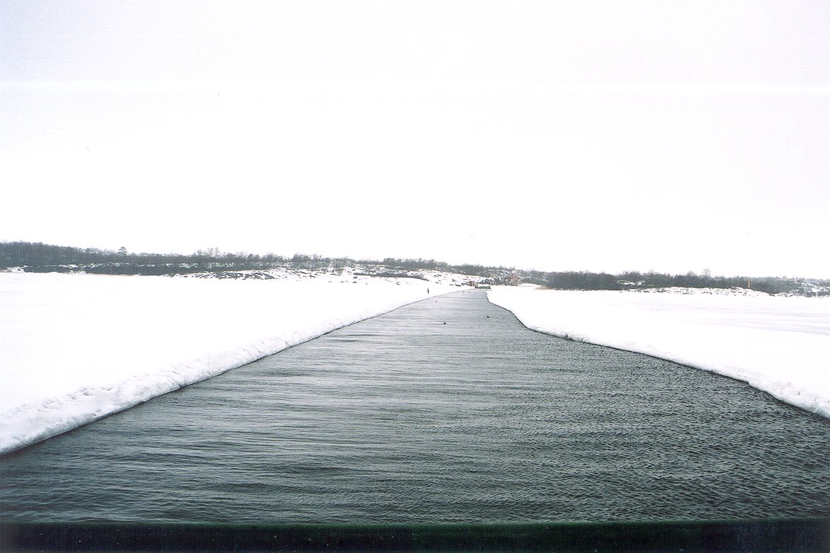
We arrived on the first bridge early enought to see it being towed over the ship channel with a tractor-powered reel. Nice! The actual travel was surprisingly uneventful. We had been expecting gaps in the ice, to be droven over using a makeshift plank "bridge", but the biggest gaps were only about 10 cm wide, and so full of snow that the Saab passed them without problems. Near biggest islands the road branched to tens of side roads, and we mostly drove by luck and some deducting. |
 the other side |
|||
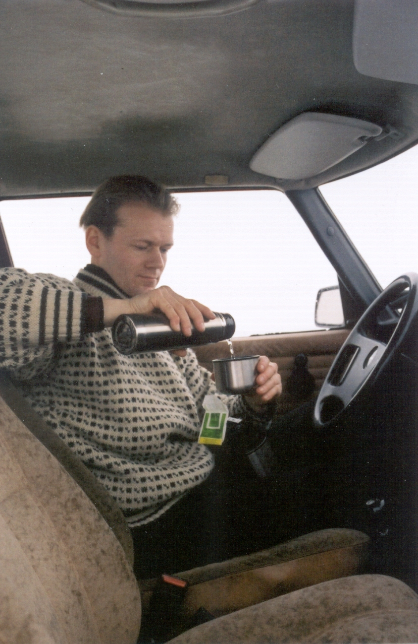 Sami and teatime |
On Lappo, we made a 10-kilometer detour because guessing wrong. Between Enklinge and Vårdö show had buried the road and we drove just by the compass needle, the after several kilometers we met the original road again. Over and all, the journey took about four hours, which was much less that we had estimated. Our average speed was about 55 kilometers per hour, the maximum about 80 km/h and minimum a crawling when we had to be careful about cracks in the ice. From the start to end, the trip was a great exhilaration. We had a coffee pause in Mariehamn, did some sighseeing and came back with a ferry. We carefully discussed driving back, but opted for a big meal on the ferry. :) |
 instructions |
|||
|
|
|||||
 |
|||||
|
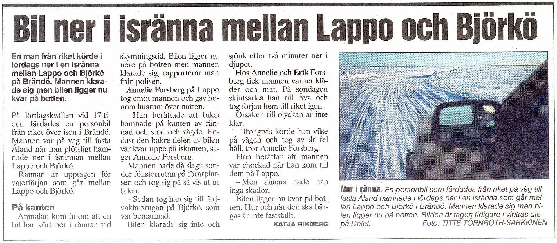
No, this was not us. :) (The article says "a car fell to an ice crack near the island Björkö") |
|||||